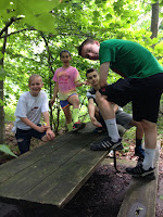
Even though I have lived in this area since 1996, I had NO idea that there is a 1,200+ acre forest/ tree preserve right around the corner. There is sits, less than 5 miles out of the city parts of Harrisburg. So this is where we decided to head for 2015's first Adventure Tuesday! (Can you hear the trumpeting music??)
PLANNING
Not a lot of planning is needed for this adventure: some bug spray (it was not buggy, but can't be too careful), sun block- but turns out that it was really not needed as the hike is 95% shaded, water, perhaps some snacks and a trash bag- as it is carry in/carry out. The most important thing to bring is a map (assuming you can read one). Maps can be printed out here: http://www.dcnr.state.pa.us/stateparks/findapark/boydbigtreepreserve/
THE DRIVE
Seriously close by! Boyd is 2.5 miles past Fort Hunter. It took about 12 minutes door-to-door going through the city.
ARRIVAL
 |
| T, R, A, M |
As soon as we turned off the main road it felt as though we were transported into a different place. Green meadows flank the road as it changes from macadam to gravel. The parking area is a nice size and already had a few cars in it. There is also a nice, clean, covered amphitheater, and real (although slightly fly infested) rest rooms right at the start of the trail head.
THE ADVENTURE
Originally, we had opted for the Upper Spring Trail: 2 miles, beige blazes, more difficult hiking
This trail provides the hiker with a nice cross-sectional view of the conservation area. This is an excellent trail to see some of the largest trees in the area. These large second growth oaks, hickories and beeches could be old growth stands in the future.

 HOWEVER... upon looking up the area on a geocaching website, we (mostly me) thought it would be cool to try to find them and they were supposed to be along the Janie Trail: 2.8 miles, red blazes, most difficult hiking. This is the longest and most challenging trail in the conservation area. It follows the ridge top and comes down the mountain on a steep slope. A red-blazed spur leads to a parking lot on the Blue Mountain Parkway.
The trails are well marked and the blazes are easy to see. We followed red into the woods and were on our way. The tall trees create a lovely canopy that creates a perfect shade allowing lots of light, but keeps you cool. The trail itself can go from 4 people wide to single file.
 |
| At Baloney Park |
 |
| Awesome view |

 Once upon the ridge, our path took us through a lovely meadow complete with butterflies and wild flowers. Back into the woods on the far side of the meadow, we entered Baloney Park (Boyd and Maloney)- private property with permission to hike, we kept on, looking for the geocaches. Eventually, I pulled out my phone and tried to use the compass latitude/ longitude to guide us to them. We seemed so close (only a few degrees away), so close...closer...closer.... nothing. We could not find them.
 Not only could we not find them, but upon reaching where they "should" be, we were at 4.5 miles and still had to loop back to the cars. We doubled back and continued our trek on the back end of the Janie Trail. It was going back that the map really came in handy. There were a few junctions that we were glad to be able to reference the map to find our way out. We also saw a few others on the trails doing the exact same thing. 8.5 miles later, we were back at the amphitheater ready for lunch.
  |
| Still no Geocache |
TIPS/ TRICKS
Good hiking shoes!!! Be prepared to hike longer than the trail says. We are still uncertain how 2.8 miles turned into 8.5 miles. Clearly there was some human interference there. Don't count on finding the geocaches.
(SORRY ABOUT PICTURE QUALITY- THEY ARE ALL CELLPHONE PICS AS MY CAMERA WAS OUT OF COMMISSION)
